
ALBUQUERQUE, NM — As of Oct. 20, there are new boundaries for Albuquerque City Council districts.
The new boundaries will apply for the next 10 years. The city council approved the boundaries at their meeting in mid-September.
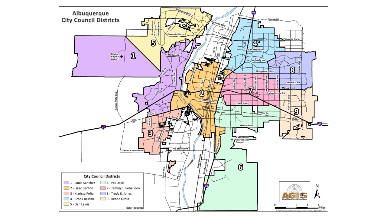
The new boundaries account for population changes. District boundaries remain identical for Districts 3, 4, and 9. Changes to other Districts include:
- District 5 had to loose population. Its boundary with District 1 moves north to the bluff south of the Petroglyph Estates.
- District 2 crosses the river between Central and I-40 to Coors taking the West Mesa and Pat Hurley neighborhoods from District 1.
- District 6 moves west into District 2 from Buena Vista to I-25 between Gibson and Lomas. District 6 also takes the University West area (including Carrie Tingley Hospital) from District 2.
- District 7 moves south into District 2 from I-40 to Lomas between I-25 and Carlisle not including the University West area.
- District 8 moves into District 7 from Montgomery to Comanche between Wyoming and Eubank.
To find your council district and city councilor, click here.
Comments are closed.